
File:" Panoramics" in The Square at Wickham - geograph.org.uk - 1497405.jpg
From Wikimedia Commons, the free media repository
No higher resolution available.
"_Panoramics"_in_The_Square_at_Wickham_-_geograph.org.uk_-_1497405.jpg (640 × 471 pixels, file size: 68 KB, MIME type: image/jpeg)
File information
Structured data
Captions
Captions
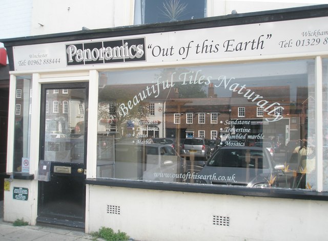
" Panoramics" in The Square at Wickham
Summary
[edit]
| Description" Panoramics" in The Square at Wickham - geograph.org.uk - 1497405.jpg |
English: " Panoramics" in The Square at Wickham |
| Date | |
| Source | From geograph.org.uk |
| Author | Basher Eyre |
| Attribution (required by the license) InfoField | Basher Eyre / " Panoramics" in The Square at Wickham / |
InfoField | Basher Eyre / " Panoramics" in The Square at Wickham |
| Camera location | 50° 54′ 00″ N, 1° 11′ 18″ W | View this and other nearby images on: OpenStreetMap |
|---|
_heading:135.00&language=en)
| Object location | 50° 53′ 58″ N, 1° 11′ 15″ W | View this and other nearby images on: OpenStreetMap |
|---|
_heading:135.00&language=en)
Licensing
[edit]

|
This image was taken from the Geograph project collection. See this photograph's page on the Geograph website for the photographer's contact details. The copyright on this image is owned by Basher Eyre and is licensed for reuse under the Creative Commons Attribution-ShareAlike 2.0 license.
|
This file is licensed under the Creative Commons Attribution-Share Alike 2.0 Generic license.
Attribution: Basher Eyre
- You are free:
- to share – to copy, distribute and transmit the work
- to remix – to adapt the work
- Under the following conditions:
- attribution – You must give appropriate credit, provide a link to the license, and indicate if changes were made. You may do so in any reasonable manner, but not in any way that suggests the licensor endorses you or your use.
- share alike – If you remix, transform, or build upon the material, you must distribute your contributions under the same or compatible license as the original.
File history
Click on a date/time to view the file as it appeared at that time.
| Date/Time | Thumbnail | Dimensions | User | Comment | |
|---|---|---|---|---|---|
| current | 16:29, 2 March 2011 | | 640 × 471 (68 KB) | GeographBot (talk | contribs) | == {{int:filedesc}} == {{Information |description={{en|1=" Panoramics" in The Square at Wickham}} |date=2009-09-19 |source=From [http://www.geograph.org.uk/photo/1497405 geograph.org.uk] |author=[http://www.geograph.org.uk/profile/17822 Basher Eyre] |perm |
You cannot overwrite this file.
File usage on Commons
There are no pages that use this file.
Structured data
depicts"}},"text//plain":{"en":{"":"depicts"}}},"{/"value/":{/"entity-type/":/"item/",/"numeric-id/":213441,/"id/":/"Q213441/"},/"type/":/"wikibase-entityid/"}":{"text//html":{"en":{"P180":"shop"}},"text//plain":{"en":{"P180":"shop"}}},"{/"value/":{/"entity-type/":/"item/",/"numeric-id/":642227,/"id/":/"Q642227/"},/"type/":/"wikibase-entityid/"}":{"text//html":{"en":{"P180":"Wickham"}},"text//plain":{"en":{"P180":"Wickham"}}}}" class="wbmi-entityview-statementsGroup wbmi-entityview-statementsGroup-P180 oo-ui-layout oo-ui-panelLayout oo-ui-panelLayout-framed">
creator"}},"text//plain":{"en":{"":"creator"}}},"{/"value/":{/"entity-type/":/"property/",/"numeric-id/":2699,/"id/":/"P2699/"},/"type/":/"wikibase-entityid/"}":{"text//html":{"en":{"":"URL"}},"text//plain":{"en":{"":"URL"}}},"{/"value/":/"https:////////www.geograph.org.uk////profile////17822/",/"type/":/"string/"}":{"text//html":{"en":{"P2699":"https:////www.geograph.org.uk//profile//17822"}},"text//plain":{"en":{"P2699":"https:////www.geograph.org.uk//profile//17822"}}},"{/"value/":{/"entity-type/":/"property/",/"numeric-id/":3831,/"id/":/"P3831/"},/"type/":/"wikibase-entityid/"}":{"text//html":{"en":{"":"object of statement has role<\/a>"}},"text\/plain":{"en":{"":"object of statement has role"}}},"{\"value\":{\"entity-type\":\"item\",\"numeric-id\":33231,\"id\":\"Q33231\"},\"type\":\"wikibase-entityid\"}":{"text\/html":{"en":{"P3831":"<a target=\"_blank\" title=\"d:Special:EntityPage\/Q33231\" href=https://commons.wikimedia.org/"https:////www.wikidata.org//wiki//Special:EntityPage//Q33231/">photographer"}},"text//plain":{"en":{"P3831":"photographer"}}},"{/"value/":{/"entity-type/":/"property/",/"numeric-id/":2093,/"id/":/"P2093/"},/"type/":/"wikibase-entityid/"}":{"text//html":{"en":{"":"author name string<\/a>"}},"text\/plain":{"en":{"":"author name string"}}},"{\"value\":\"Basher Eyre\",\"type\":\"string\"}":{"text\/html":{"en":{"P2093":"Basher Eyre"}},"text\/plain":{"en":{"P2093":"Basher Eyre"}}}}" class="wbmi-entityview-statementsGroup wbmi-entityview-statementsGroup-P170 oo-ui-layout oo-ui-panelLayout oo-ui-panelLayout-framed">
copyright status<\/a>"}},"text\/plain":{"en":{"":"copyright status"}}},"{\"value\":{\"entity-type\":\"item\",\"numeric-id\":50423863,\"id\":\"Q50423863\"},\"type\":\"wikibase-entityid\"}":{"text\/html":{"en":{"P6216":"<a target=\"_blank\" title=\"d:Special:EntityPage\/Q50423863\" href=https://commons.wikimedia.org/"https:////www.wikidata.org//wiki//Special:EntityPage//Q50423863/">copyrighted"}},"text//plain":{"en":{"P6216":"copyrighted"}}}}" class="wbmi-entityview-statementsGroup wbmi-entityview-statementsGroup-P6216 oo-ui-layout oo-ui-panelLayout oo-ui-panelLayout-framed">
copyright license<\/a>"}},"text\/plain":{"en":{"":"copyright license"}}},"{\"value\":{\"entity-type\":\"item\",\"numeric-id\":19068220,\"id\":\"Q19068220\"},\"type\":\"wikibase-entityid\"}":{"text\/html":{"en":{"P275":"<a target=\"_blank\" title=\"d:Special:EntityPage\/Q19068220\" href=https://commons.wikimedia.org/"https:////www.wikidata.org//wiki//Special:EntityPage//Q19068220/">Creative Commons Attribution-ShareAlike 2.0 Generic<\/a>"}},"text\/plain":{"en":{"P275":"Creative Commons Attribution-ShareAlike 2.0 Generic"}}},"{\"value\":{\"entity-type\":\"property\",\"numeric-id\":1476,\"id\":\"P1476\"},\"type\":\"wikibase-entityid\"}":{"text\/html":{"en":{"":"<a target=\"_blank\" title=\"d:Special:EntityPage\/P1476\" href=https://commons.wikimedia.org/"https:////www.wikidata.org//wiki//Special:EntityPage//P1476/">title"}},"text//plain":{"en":{"":"title"}}},"{/"value/":{/"text/":/"///" Panoramics\\\" in The Square at Wickham\",\"language\":\"en\"},\"type\":\"monolingualtext\"}":{"text\/html":{"en":{"P1476":"<span lang=\"en\" class=\"wb-monolingualtext-value\">\" Panoramics\" in The Square at Wickham<\/span> <span class=\"wb-monolingualtext-language-name\" dir=\"auto\">(English)<\/span>"}},"text\/plain":{"en":{"P1476":"\" Panoramics\" in The Square at Wickham"}}},"{\"value\":{\"entity-type\":\"property\",\"numeric-id\":2093,\"id\":\"P2093\"},\"type\":\"wikibase-entityid\"}":{"text\/html":{"en":{"":"<a target=\"_blank\" title=\"d:Special:EntityPage\/P2093\" href=https://commons.wikimedia.org/"https:////www.wikidata.org//wiki//Special:EntityPage//P2093/">author name string<\/a>"}},"text\/plain":{"en":{"":"author name string"}}},"{\"value\":\"Basher Eyre\",\"type\":\"string\"}":{"text\/html":{"en":{"P2093":"Basher Eyre"}},"text\/plain":{"en":{"P2093":"Basher Eyre"}}}}" class="wbmi-entityview-statementsGroup wbmi-entityview-statementsGroup-P275 oo-ui-layout oo-ui-panelLayout oo-ui-panelLayout-framed">
coordinates of the point of view<\/a>"}},"text\/plain":{"en":{"":"coordinates of the point of view"}}},"{\"value\":{\"latitude\":50.90002,\"longitude\":-1.1883,\"altitude\":null,\"precision\":1.0e-5,\"globe\":\"http:\\\/\\\/www.wikidata.org\\\/entity\\\/Q2\"},\"type\":\"globecoordinate\"}":{"text\/html":{"en":{"P1259":"50\u00b054'0.07"N, 1\u00b011'17.88"W"}},"text\/plain":{"en":{"P1259":"50\u00b054'0.07\"N, 1\u00b011'17.88\"W"}}},"{\"value\":{\"entity-type\":\"property\",\"numeric-id\":7787,\"id\":\"P7787\"},\"type\":\"wikibase-entityid\"}":{"text\/html":{"en":{"":"<a target=\"_blank\" title=\"d:Special:EntityPage\/P7787\" href=https://commons.wikimedia.org/"https:////www.wikidata.org//wiki//Special:EntityPage//P7787/">heading"}},"text//plain":{"en":{"":"heading"}}},"{/"value/":{/"amount/":/"+135/",/"unit/":/"http:////////www.wikidata.org////entity////Q28390/"},/"type/":/"quantity/"}":{"text//html":{"en":{"P7787":"135 <span class=\"wb-unit\">degree<\/span>"}},"text\/plain":{"en":{"P7787":"135 degree"}}}}" class="wbmi-entityview-statementsGroup wbmi-entityview-statementsGroup-P1259 oo-ui-layout oo-ui-panelLayout oo-ui-panelLayout-framed">
50°54'0.07"N, 1°11'17.88"W
inception"}},"text//plain":{"en":{"":"inception"}}},"{/"value/":{/"time/":/"+2009-09-19T00:00:00Z/",/"timezone/":0,/"before/":0,/"after/":0,/"precision/":11,/"calendarmodel/":/"http:////////www.wikidata.org////entity////Q1985727/"},/"type/":/"time/"}":{"text//html":{"en":{"P571":"19 September 2009"}},"text\/plain":{"en":{"P571":"19 September 2009"}}}}" class="wbmi-entityview-statementsGroup wbmi-entityview-statementsGroup-P571 oo-ui-layout oo-ui-panelLayout oo-ui-panelLayout-framed">
19 September 2009
source of file<\/a>"}},"text\/plain":{"en":{"":"source of file"}}},"{\"value\":{\"entity-type\":\"item\",\"numeric-id\":74228490,\"id\":\"Q74228490\"},\"type\":\"wikibase-entityid\"}":{"text\/html":{"en":{"P7482":"<a target=\"_blank\" title=\"d:Special:EntityPage\/Q74228490\" href=https://commons.wikimedia.org/"https:////www.wikidata.org//wiki//Special:EntityPage//Q74228490/">file available on the internet<\/a>"}},"text\/plain":{"en":{"P7482":"file available on the internet"}}},"{\"value\":{\"entity-type\":\"property\",\"numeric-id\":973,\"id\":\"P973\"},\"type\":\"wikibase-entityid\"}":{"text\/html":{"en":{"":"<a target=\"_blank\" title=\"d:Special:EntityPage\/P973\" href=https://commons.wikimedia.org/"https:////www.wikidata.org//wiki//Special:EntityPage//P973/">described at URL<\/a>"}},"text\/plain":{"en":{"":"described at URL"}}},"{\"value\":\"https:\\\/\\\/www.geograph.org.uk\\\/photo\\\/1497405\",\"type\":\"string\"}":{"text\/html":{"en":{"P973":"<a target=\"_blank\" rel=\"nofollow\" class=\"external free\" href=https://commons.wikimedia.org/"https:////www.geograph.org.uk//photo//1497405/">https:////www.geograph.org.uk//photo//1497405"}},"text//plain":{"en":{"P973":"https:////www.geograph.org.uk//photo//1497405"}}},"{/"value/":{/"entity-type/":/"property/",/"numeric-id/":137,/"id/":/"P137/"},/"type/":/"wikibase-entityid/"}":{"text//html":{"en":{"":"operator"}},"text//plain":{"en":{"":"operator"}}},"{/"value/":{/"entity-type/":/"item/",/"numeric-id/":1503119,/"id/":/"Q1503119/"},/"type/":/"wikibase-entityid/"}":{"text//html":{"en":{"P137":"Geograph Britain and Ireland<\/a>"}},"text\/plain":{"en":{"P137":"Geograph Britain and Ireland"}}},"{\"value\":{\"entity-type\":\"property\",\"numeric-id\":7384,\"id\":\"P7384\"},\"type\":\"wikibase-entityid\"}":{"text\/html":{"en":{"":"<a target=\"_blank\" title=\"d:Special:EntityPage\/P7384\" href=https://commons.wikimedia.org/"https:////www.wikidata.org//wiki//Special:EntityPage//P7384/">geograph.org.uk image ID<\/a>"}},"text\/plain":{"en":{"":"geograph.org.uk image ID"}}},"{\"value\":\"1497405\",\"type\":\"string\"}":{"text\/html":{"en":{"P7384":"<a target=\"_blank\" class=\"wb-external-id external\" href=https://commons.wikimedia.org/"https:////www.geograph.org.uk//photo//1497405/" rel=\"nofollow\">1497405<\/a>"}},"text\/plain":{"en":{"P7384":"1497405"}}}}" class="wbmi-entityview-statementsGroup wbmi-entityview-statementsGroup-P7482 oo-ui-layout oo-ui-panelLayout oo-ui-panelLayout-framed">
coordinates of depicted place<\/a>"}},"text\/plain":{"en":{"":"coordinates of depicted place"}}},"{\"value\":{\"latitude\":50.89956,\"longitude\":-1.1876,\"altitude\":null,\"precision\":1.0e-5,\"globe\":\"http:\\\/\\\/www.wikidata.org\\\/entity\\\/Q2\"},\"type\":\"globecoordinate\"}":{"text\/html":{"en":{"P9149":"50\u00b053'58.42"N, 1\u00b011'15.36"W"}},"text\/plain":{"en":{"P9149":"50\u00b053'58.42\"N, 1\u00b011'15.36\"W"}}},"{\"value\":{\"entity-type\":\"property\",\"numeric-id\":7787,\"id\":\"P7787\"},\"type\":\"wikibase-entityid\"}":{"text\/html":{"en":{"":"<a target=\"_blank\" title=\"d:Special:EntityPage\/P7787\" href=https://commons.wikimedia.org/"https:////www.wikidata.org//wiki//Special:EntityPage//P7787/">heading"}},"text//plain":{"en":{"":"heading"}}},"{/"value/":{/"amount/":/"+135/",/"unit/":/"http:////////www.wikidata.org////entity////Q28390/"},/"type/":/"quantity/"}":{"text//html":{"en":{"P7787":"135 <span class=\"wb-unit\">degree<\/span>"}},"text\/plain":{"en":{"P7787":"135 degree"}}}}" class="wbmi-entityview-statementsGroup wbmi-entityview-statementsGroup-P9149 oo-ui-layout oo-ui-panelLayout oo-ui-panelLayout-framed">
50°53'58.42"N, 1°11'15.36"W
media type<\/a>"}},"text\/plain":{"en":{"":"media type"}}},"{\"value\":\"image\\\/jpeg\",\"type\":\"string\"}":{"text\/html":{"en":{"P1163":"image\/jpeg"}},"text\/plain":{"en":{"P1163":"image\/jpeg"}}}}" class="wbmi-entityview-statementsGroup wbmi-entityview-statementsGroup-P1163 oo-ui-layout oo-ui-panelLayout oo-ui-panelLayout-framed">
image/jpeg
checksum"}},"text//plain":{"en":{"":"checksum"}}},"{/"value/":/"92536f5fc38aec316321419ae1adb0ebe553d3b5/",/"type/":/"string/"}":{"text//html":{"en":{"P4092":"92536f5fc38aec316321419ae1adb0ebe553d3b5"}},"text//plain":{"en":{"P4092":"92536f5fc38aec316321419ae1adb0ebe553d3b5"}}},"{/"value/":{/"entity-type/":/"property/",/"numeric-id/":459,/"id/":/"P459/"},/"type/":/"wikibase-entityid/"}":{"text//html":{"en":{"":"determination method or standard<\/a>"}},"text\/plain":{"en":{"":"determination method or standard"}}},"{\"value\":{\"entity-type\":\"item\",\"numeric-id\":13414952,\"id\":\"Q13414952\"},\"type\":\"wikibase-entityid\"}":{"text\/html":{"en":{"P459":"<a target=\"_blank\" title=\"d:Special:EntityPage\/Q13414952\" href=https://commons.wikimedia.org/"https:////www.wikidata.org//wiki//Special:EntityPage//Q13414952/">SHA-1"}},"text//plain":{"en":{"P459":"SHA-1"}}}}" class="wbmi-entityview-statementsGroup wbmi-entityview-statementsGroup-P4092 oo-ui-layout oo-ui-panelLayout oo-ui-panelLayout-framed">
92536f5fc38aec316321419ae1adb0ebe553d3b5
data size<\/a>"}},"text\/plain":{"en":{"":"data size"}}},"{\"value\":{\"amount\":\"+70054\",\"unit\":\"http:\\\/\\\/www.wikidata.org\\\/entity\\\/Q8799\"},\"type\":\"quantity\"}":{"text\/html":{"en":{"P3575":"70,054 <span class=\"wb-unit\">byte<\/span>"}},"text\/plain":{"en":{"P3575":"70,054 byte"}}}}" class="wbmi-entityview-statementsGroup wbmi-entityview-statementsGroup-P3575 oo-ui-layout oo-ui-panelLayout oo-ui-panelLayout-framed">
70,054 byte
height"}},"text//plain":{"en":{"":"height"}}},"{/"value/":{/"amount/":/"+471/",/"unit/":/"http:////////www.wikidata.org////entity////Q355198/"},/"type/":/"quantity/"}":{"text//html":{"en":{"P2048":"471 <span class=\"wb-unit\">pixel<\/span>"}},"text\/plain":{"en":{"P2048":"471 pixel"}}}}" class="wbmi-entityview-statementsGroup wbmi-entityview-statementsGroup-P2048 oo-ui-layout oo-ui-panelLayout oo-ui-panelLayout-framed">
471 pixel
width"}},"text//plain":{"en":{"":"width"}}},"{/"value/":{/"amount/":/"+640/",/"unit/":/"http:////////www.wikidata.org////entity////Q355198/"},/"type/":/"quantity/"}":{"text//html":{"en":{"P2049":"640 <span class=\"wb-unit\">pixel<\/span>"}},"text\/plain":{"en":{"P2049":"640 pixel"}}}}" class="wbmi-entityview-statementsGroup wbmi-entityview-statementsGroup-P2049 oo-ui-layout oo-ui-panelLayout oo-ui-panelLayout-framed">
640 pixel
geograph.org.uk image ID<\/a>"}},"text\/plain":{"en":{"":"geograph.org.uk image ID"}}},"{\"value\":\"1497405\",\"type\":\"string\"}":{"text\/html":{"en":{"P7384":"<a target=\"_blank\" class=\"wb-external-id external\" href=https://commons.wikimedia.org/"https:////www.geograph.org.uk//photo//1497405/" rel=\"nofollow\">1497405<\/a>"}},"text\/plain":{"en":{"P7384":"1497405"}}}}" class="wbmi-entityview-statementsGroup wbmi-entityview-statementsGroup-P7384 oo-ui-layout oo-ui-panelLayout oo-ui-panelLayout-framed">
instance of<\/a>"}},"text\/plain":{"en":{"":"instance of"}}},"{\"value\":{\"entity-type\":\"item\",\"numeric-id\":125191,\"id\":\"Q125191\"},\"type\":\"wikibase-entityid\"}":{"text\/html":{"en":{"P31":"<a target=\"_blank\" title=\"d:Special:EntityPage\/Q125191\" href=https://commons.wikimedia.org/"https:////www.wikidata.org//wiki//Special:EntityPage//Q125191/">photograph"}},"text//plain":{"en":{"P31":"photograph"}}}}" class="wbmi-entityview-statementsGroup wbmi-entityview-statementsGroup-P31 oo-ui-layout oo-ui-panelLayout oo-ui-panelLayout-framed">
location of creation<\/a>"}},"text\/plain":{"en":{"":"location of creation"}}},"{\"value\":{\"entity-type\":\"item\",\"numeric-id\":642227,\"id\":\"Q642227\"},\"type\":\"wikibase-entityid\"}":{"text\/html":{"en":{"P1071":"<a target=\"_blank\" title=\"d:Special:EntityPage\/Q642227\" href=https://commons.wikimedia.org/"https:////www.wikidata.org//wiki//Special:EntityPage//Q642227/">Wickham"}},"text//plain":{"en":{"P1071":"Wickham"}}}}" class="wbmi-entityview-statementsGroup wbmi-entityview-statementsGroup-P1071 oo-ui-layout oo-ui-panelLayout oo-ui-panelLayout-framed">